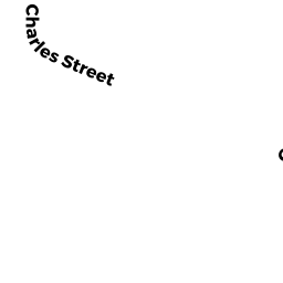
43-45 CHARLES ST AUB
Owner Information
OBRIEN MARK F JR & MARIE A
43 CHARLES ST
AUBURNDALE, MA 02466


Property Details
43-45 CHARLES ST AUB is classified as a Two-Family Residential (Two family).
The primary structure on this property was built in 1960. There are 3,597ft2 of built area within this property. There is 2,214ft2 of residential/living space within this property. This property is listed as having 9 rooms.
43-45 CHARLES ST AUB is valued at $786,300. The land is valued at $505,900 and the structures are valued at $280,400.
This property is in Zone MR1. Confirm with local Zoning Board authorities to ensure there are no overlays or other easements on this property.
The most recent deed for 43-45 CHARLES ST AUB is recorded at the local registrar in Book 10564, Page 97. 43-45 CHARLES ST AUB was last sold on Monday, January 1, 1900 for $1.
Assessment data from fiscal year 2022.
Flood Data
According to the FEMA National Flood Hazard Layer, this property does not appear to be in a flood zone. It may also be in an area not yet reviewed. Nonetheless, confirm this information prior to taking any action.
To view the flood hazards around this property, create a FEMA "Firmette" Map of the area around 43-45 CHARLES ST AUB.
Broadband Internet Providers
| Provider | Type | Bandwidth (mbps) | |
|---|---|---|---|
| VSAT Systems, LLC. | Satellite | 2 | 1 |
| Comcast | Cable | 1000 | 35 |
| Verizon New England Inc. | DSL | 5 | 0 |
| Verizon New England Inc. | Fiber | 940 | 880 |
| RCN | Cable | 500 | 20 |
| RCN | Cable | 1000 | 20 |
| T-Mobile | Fixed Wireless | 25 | 3 |
| GCI Communication Corp. | Satellite | 0 | 0 |
| HughesNet | Satellite | 25 | 3 |
| Viasat Inc | Satellite | 100 | 3 |
Broadband service provider data from December 2020.
Adjacent Properties
- 39 CHARLES ST AUB #A
Residential Condominium owned by GERSHENFELD JOEL - 39 CHARLES ST AUB #B
Residential Condominium owned by BAKER ROBERT & JANA - 39 CHARLES ST AUB
Other, Open Space owned by 39 CHARLES STREET MASTER DEED - 570 AUBURN ST 570
Residential Condominium owned by FREIBURGHOUSE EUGENIA K TR - 572 AUBURN ST 572
Residential Condominium owned by STURMAN THEODORE S - 574 AUBURN ST 574
Residential Condominium owned by ZHENG YANYAN - 576 AUBURN ST 576
Residential Condominium owned by PRESTON LAWRENCE R & JEAN F TRS - 578 AUBURN ST 578
Residential Condominium owned by TAKVORIAN BRYAN R - 580 AUBURN ST 580
Residential Condominium owned by MUROS JOAN M - 570-580 AUBURN ST
Other, Open Space owned by 570-580 AUBURN ST MASTER DEED - 49 CHARLES ST AUB 1
Residential Condominium owned by STARR ALAN M & LAUREN A - 47-49 CHARLES ST AUB
Other, Open Space owned by 47-49 CHARLES ST AUB MASTER DEED